In the context of maritime security and vessel investigations, OSINT has become an indispensable tool. It enables law enforcement agencies, journalists, environmental watchdogs, and researchers to track vessel movements, verify activities, detect illicit behavior, and enforce maritime laws without relying solely on classified or proprietary data.
Traditional surveillance methods like satellites, naval patrols, and radar systems are expensive and resource-intensive. OSINT fills a critical gap by offering low-cost, accessible alternatives that help track vessel locations and movements, identify suspicious behavior (e.g., AIS manipulation, loitering, dark activities), verify compliance with sanctions and maritime law, investigate environmental crimes (e.g., illegal fishing, oil dumping), and support litigation and journalism with documented evidence.
Key OSINT Tools and Data Sources for Vessel Tracking
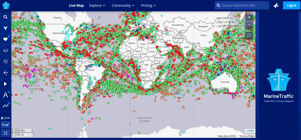
AIS is a maritime safety protocol that broadcasts a vessel’s identity, position, speed, and heading. OSINT platforms like MarineTraffic, VesselFinder, and FleetMon aggregate AIS data from satellites and coastal stations. Historical AIS data helps trace vessel activity over time.
Each vessel has a unique International Maritime Organization (IMO) number and Maritime Mobile Service Identity (MMSI) number. These identifiers are crucial for tracing ownership, flag changes, and ship histories.
Resources like Equasis, IHS Markit, and official flag state registries provide ownership, management, and technical details. Port call data can be found via port authority websites, Lloyd’s List, or shipping bulletins.
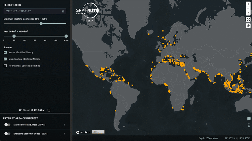
Tools such as Sentinel Hub, Google Earth, and Planet Labs provide optical and radar satellite images. Synthetic Aperture Radar (SAR) imagery is particularly useful for spotting “dark ships” operating without AIS.
Crew members, spotters, and maritime enthusiasts often post photos or reports on platforms like Facebook, Instagram, YouTube, or Reddit. These can be used to verify ship presence or behavior at specific locations.
Court records, financial disclosures, and trade data (e.g., ImportGenius or Panjiva) can reveal ownership structures and shipping patterns. NGOs and research collectives like Global Fishing Watch, SkyTruth, and AllSource Analysis share open-source vessel monitoring reports and tools.
OSINT Methodology for Vessel Investigations
Step 1: Define the ScopeStart by determining what you are investigating:
- Is it a specific ship, company, or activity?
- Are you looking for evidence of activities related to war crimes, sanctions evasion, illegal fishing, or environmental violations?
Step 2: Collect Basic Vessel InformationUse AIS and ship registry databases to gather:
- Name, IMO/MMSI numbers
- Flag state
- Type and dimensions
- Owner and operator details
This foundational data enables targeted tracking and analysis.
Step 3: Analyze Movement and BehaviorUsing platforms like MarineTraffic or Global Fishing Watch:
- Review past voyages
- Look for loitering, rendezvous at sea, or route deviations
- Identify patterns suggesting illicit transshipment or avoidance of monitored waters
Step 4: Identify Anomalies and GapsCommon red flags include:
- AIS gaps (suggesting the AIS was turned off)
- “Spoofing” (broadcasting false locations)
- Frequent flag changes or use of flags of convenience
- Proximity to marine protected areas or conflict zones
Step 5: Corroborate with Additional SourcesCross-reference:
- Satellite imagery for AIS gaps
- Port records and cargo manifests
- News, social media, or eyewitness reports
This helps verify events such as port visits, ship-to-ship transfers, or unauthorized fishing.
Step 6: Document and Report FindingsMaintain detailed logs, export data visualizations, and cite sources. Consider using tools like:
- Maltego for link analysis
- Hunchly for web capture
- QGIS for geospatial mapping
OSINT has revolutionized maritime investigations by enabling real-time, cost-effective vessel tracking and behavior analysis. While challenges remain in data reliability and access, the combination of AIS data, satellite imagery, public records, and crowdsourced information offers powerful capabilities for uncovering illegal or suspicious maritime activities.